

Three ways we work with your team.
One flagship inspection service where we do the analysis ourselves — and two data-collection lines that slot into your existing inspection or engineering workflow.
We model your line in PLS-CADD. You review it.
We capture LiDAR in the field, build the PLS-CADD model in-house from the point cloud, and deliver a finished model your engineers can load in PLS-CADD and review line-wide — no translator pass, no modeling labor on your side. A separate pipeline for photo-to-PLS-POLE is in development through the Inspection Suite (below).
Full-line coverage
Fully classified
PLS-CADD model
Built by us
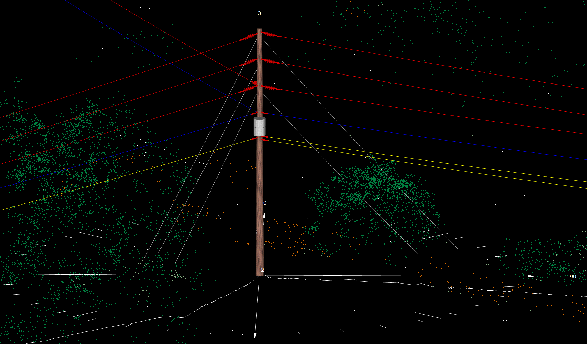
to review in
PLS-CADD
Your inspection data, in one platform.
Aerial operations are not just pilots and cameras.
Working in complex airspace adds real constraints — and real value. Every capture mission is scoped around the regulatory, sensor, and data-format requirements that turn raw flight footage into something your team can actually use.
From first call to delivered data.
Most engagements follow the same three-phase arc. We scope tightly, fly precisely, and deliver data formatted for your downstream workflow.